Written by Sophie Kalkowski-Pope
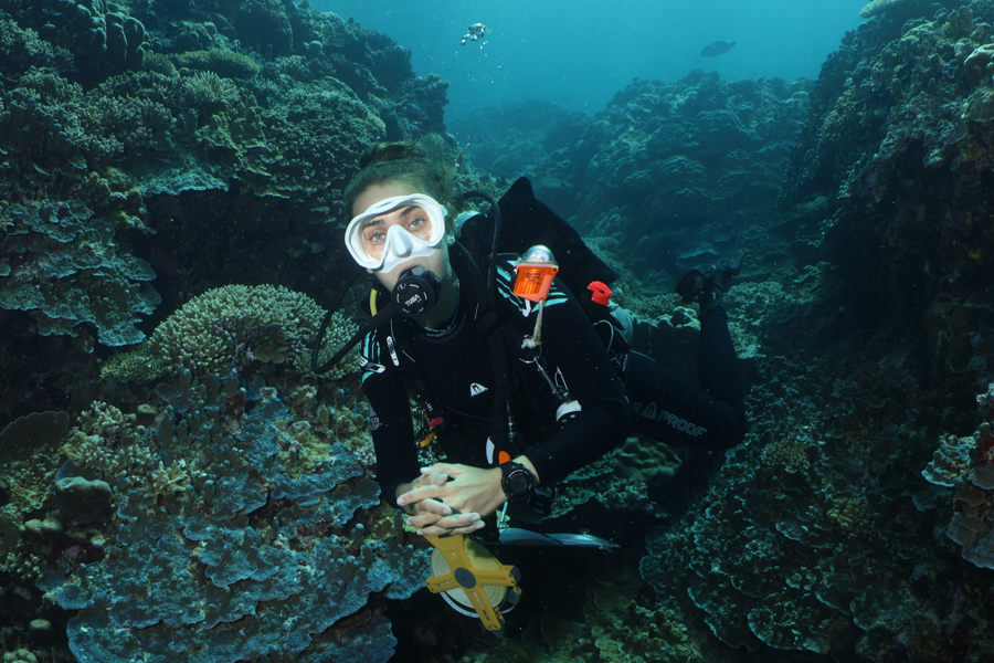
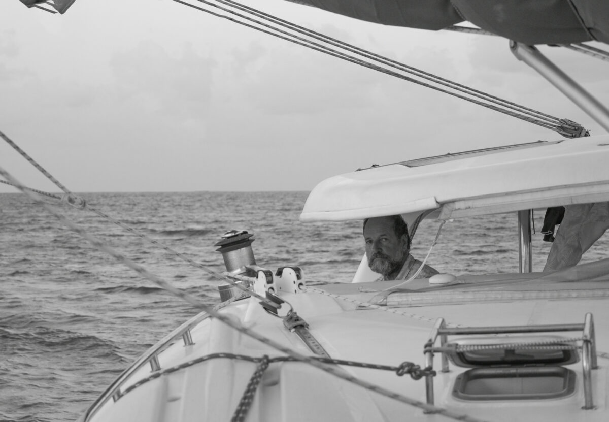
“Weights, Mask, Dive Computer, Transect, slate, GPS tracker, camera…That’s everything”.
“All good to go?” Kirsty asks,
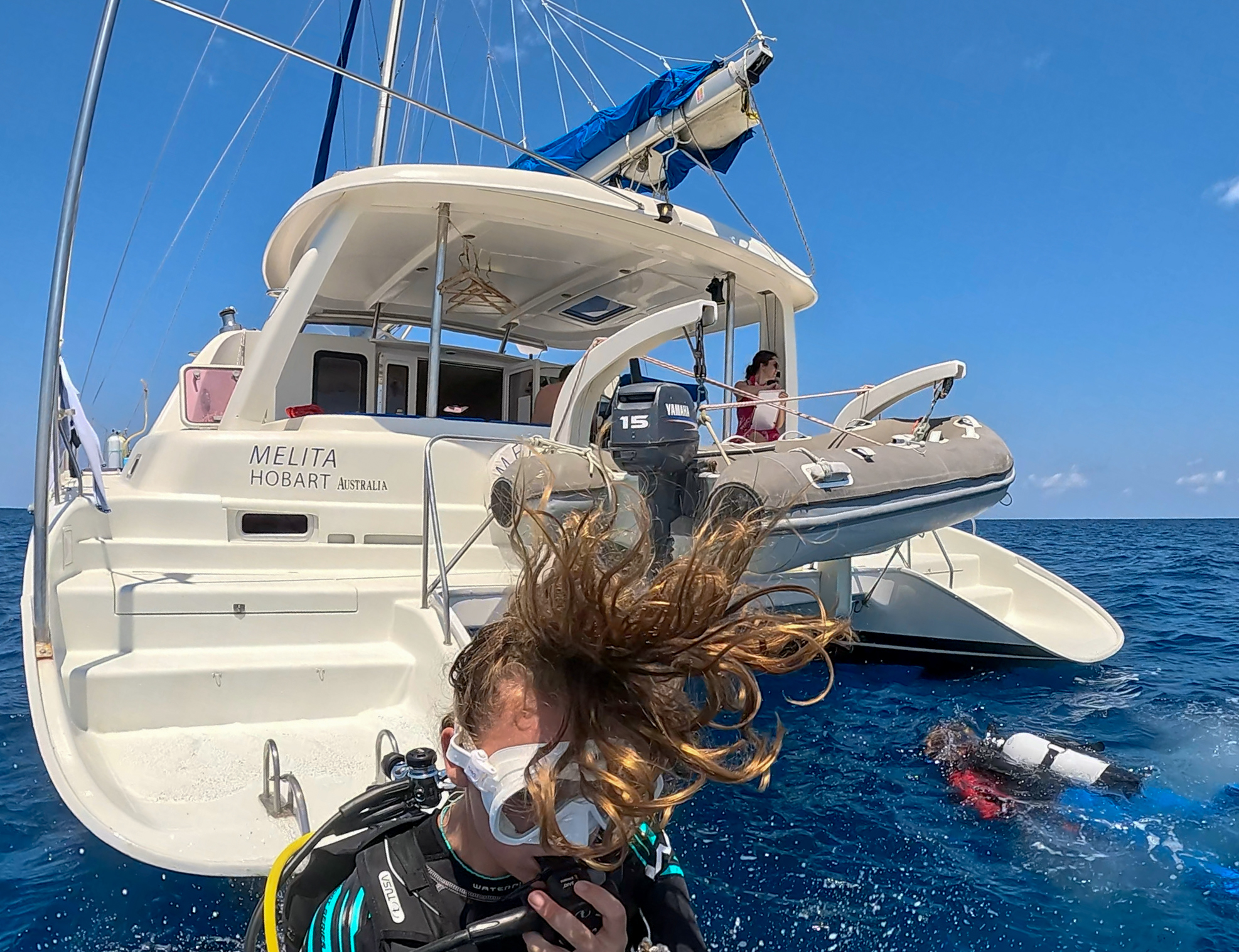
“Yup!” I reply, as we plunge into the water off the back of the catamaran.
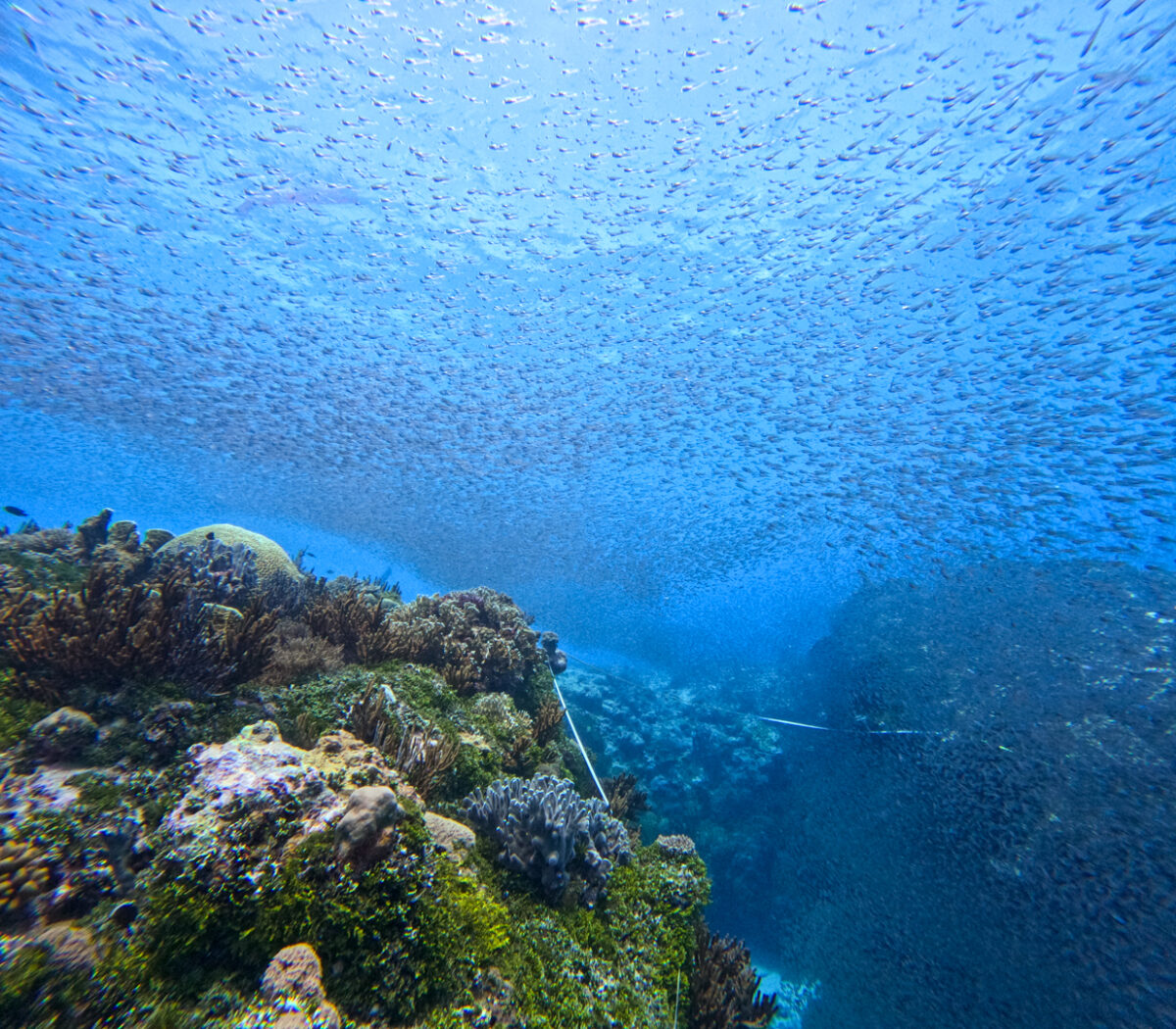
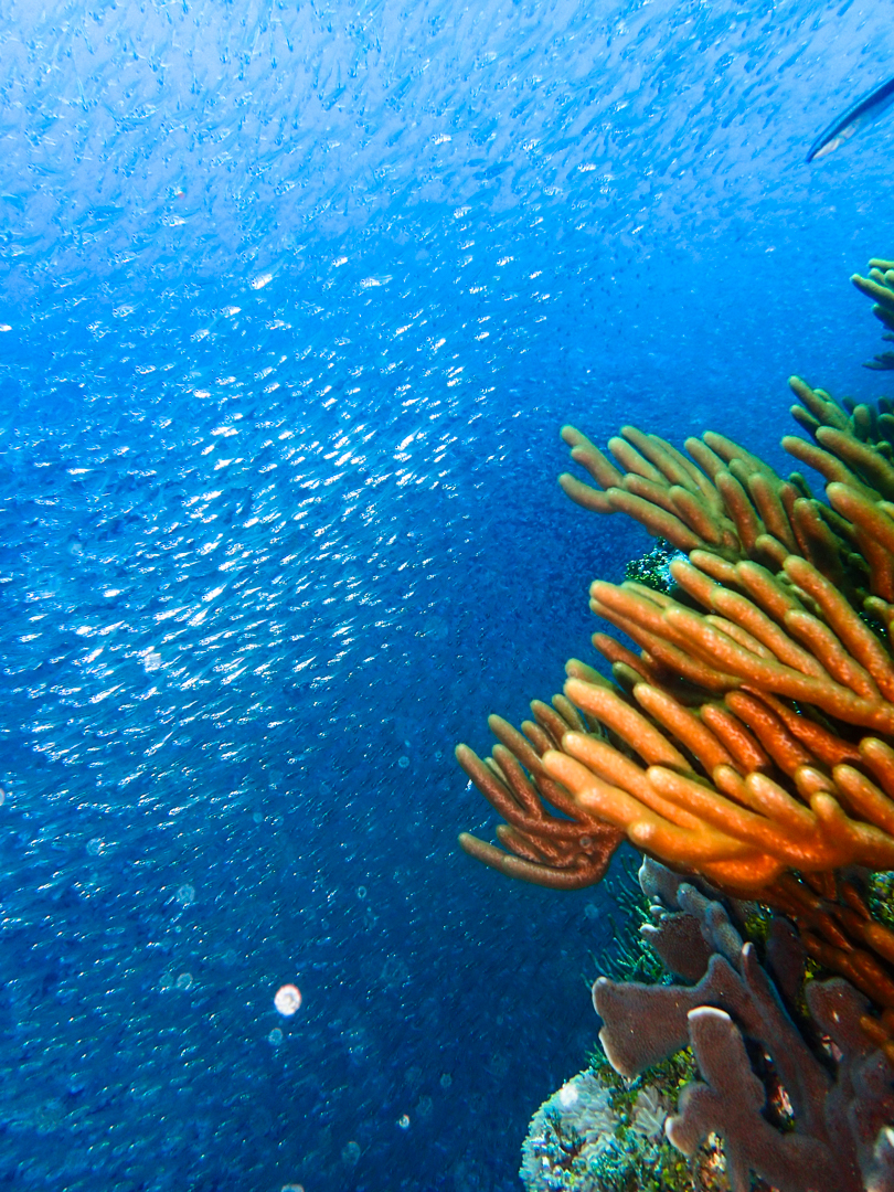
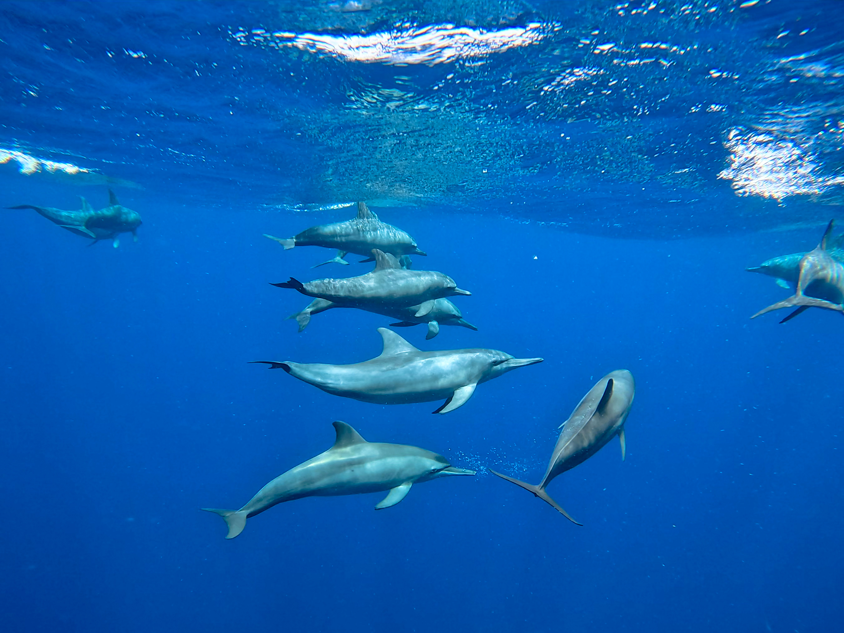
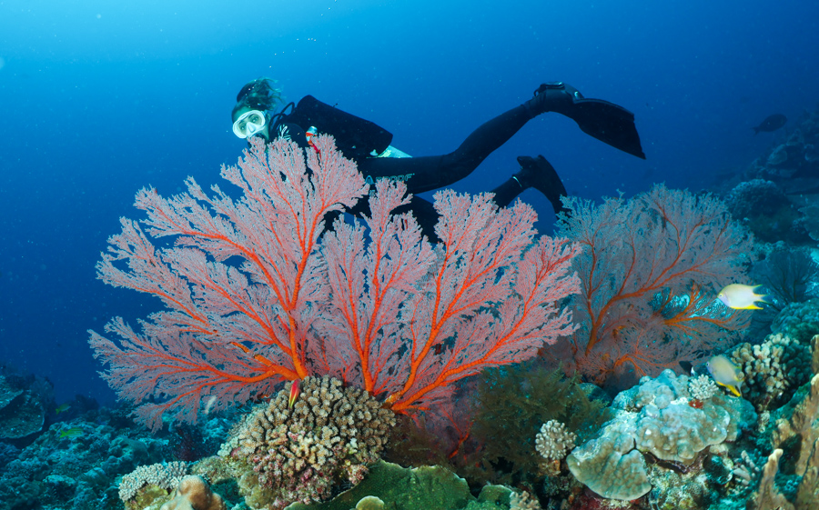
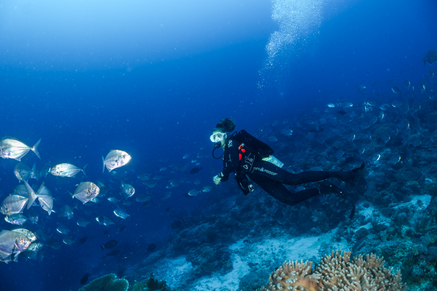
As we descend into the water column, I can’t quite believe what we were seeing. 30m visibility allows us to see in every direction, revealing thousands upon thousands of shimmering glassfish. Swimming through them was like gliding through a shifting, silver cloud, as they hovered above the reef. We look at each other with wide eyes, laughing through our regulators.
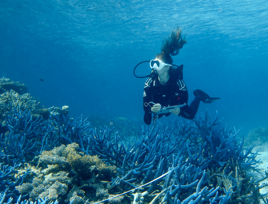
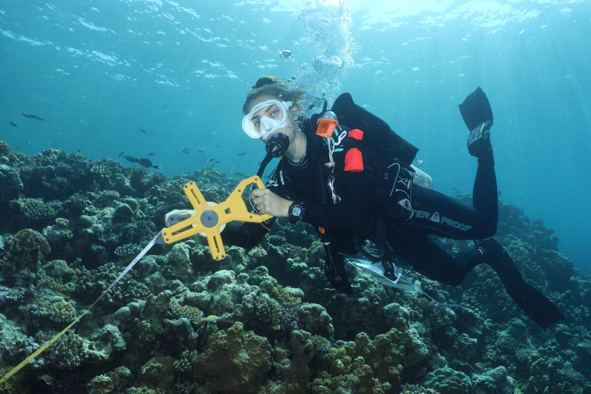
Photos will have to wait though; we’ve got data to collect! I grab my transect reel and begin rolling it out across the reef.
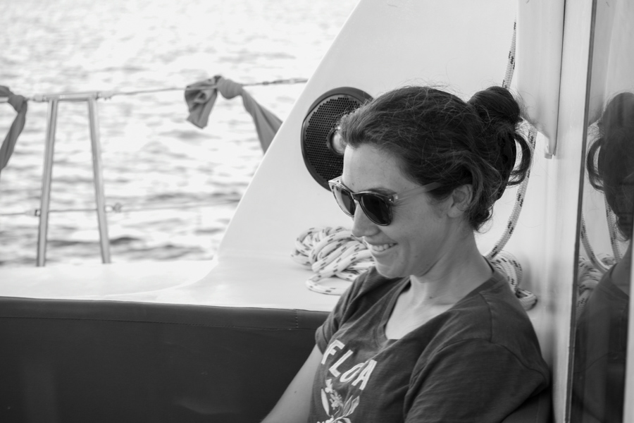
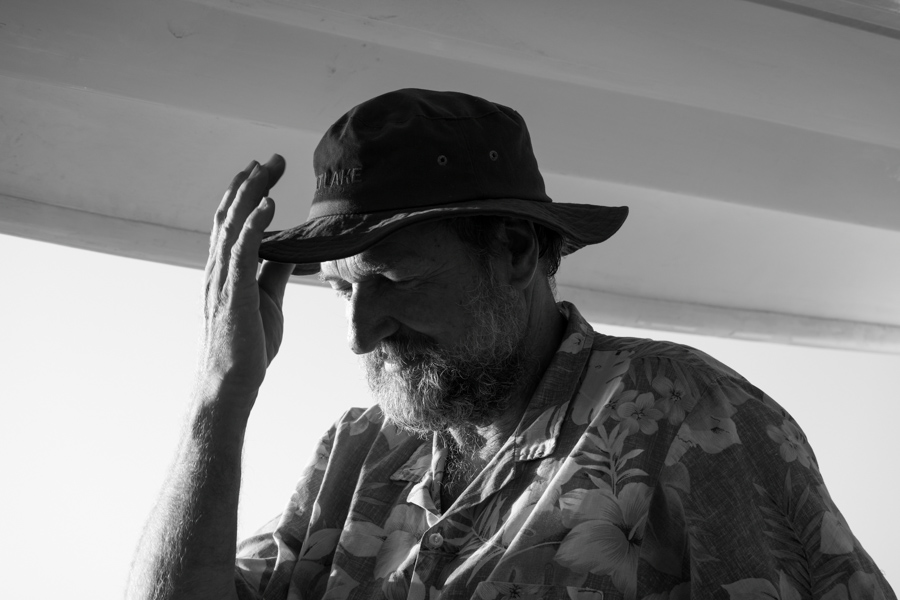
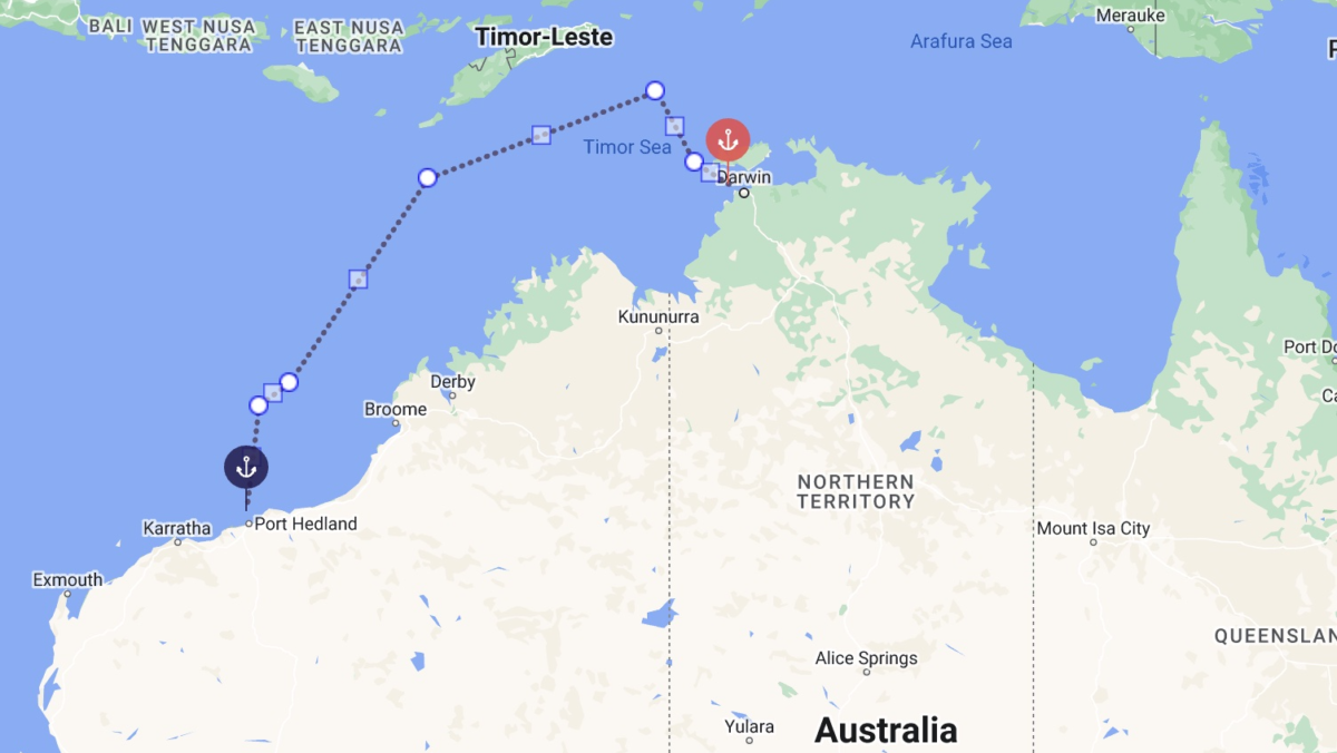
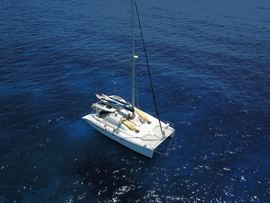
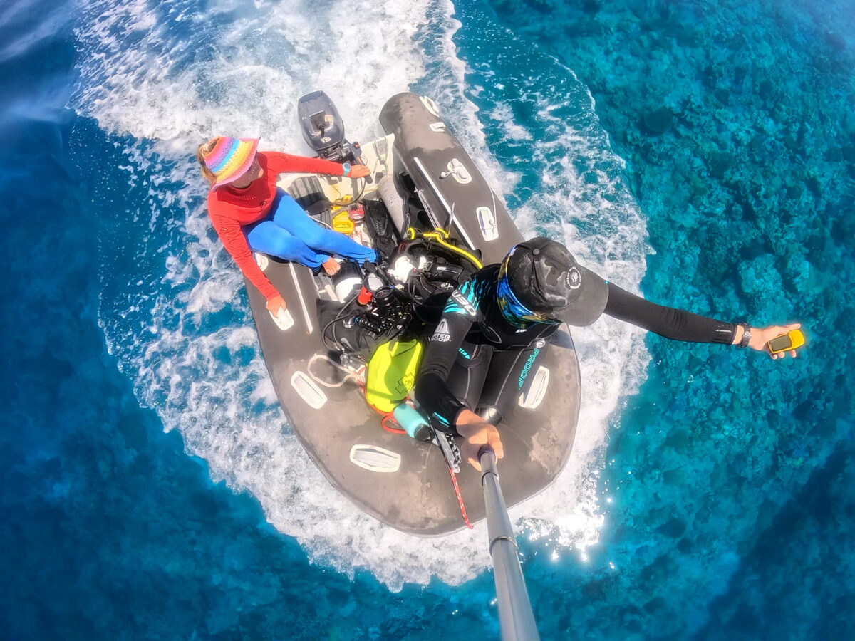
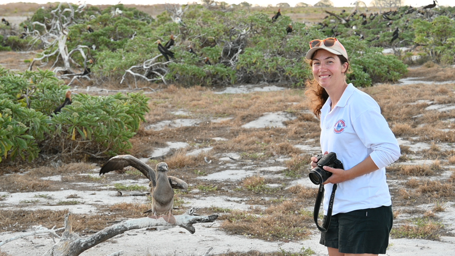
This was one of the most special dives from my recent scholarship experience with Reef Life Survey, travelling to remote reefs 300 km off the coast of northern Australia. The crew of four; Prof. Graham Edgar, Anna Edgar, Kirsty Whitman, and myself, surveyed a variety of tropical reef sites all the way from Darwin to Port Headland, including Ashmore Reef, Scott Reef, and the infamous Rowley Shoals.
In 3 ½ weeks we sailed over 1000mn, I completed 39 dives, and as a team we surveyed over 75 sites! We also established several new sites that haven’t even previously been surveyed using RLS methods.
Our journey across the North West coast of Australia
What is Reef Life Survey?
Reef Life Survey (RLS) is a non-profit citizen science program co-founded in 2007 by Professor Graham Edgar and Associate Professor Rick Stuart-Smith.’ It aims to provide comprehensive baseline data for a variety of sites around Australia, and the world.
This allows us to attempt to address sliding baseline syndrome, a phenomenon where declines in the marine environment are overlooked, because each generation remembers the environment and its relative state. The strength of the project lies in revealing the true state of our oceans to inform and critique management.
Currently there have been over 16,449 surveys of 5346 reef dwelling species across 55 countries. In Australia alone, there are over 2000 survey sites!
This is in addition to over one thousand sites overseas, surveying both temperate and tropical environments around the world. The data has been used to inform species ID books, distribution maps, and a number of highly cited papers.
All data, maps, and ID tools from RLS accessible online here. This incredible data collection effort is ongoing, providing irreplaceable baseline data. The project runs on the efforts of countless volunteers, donors are always appreciated to keep the field activities running.
The methods
The methodology aims to collect the most comprehensive information about a reef system in the most time efficient manner.
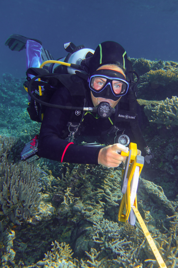
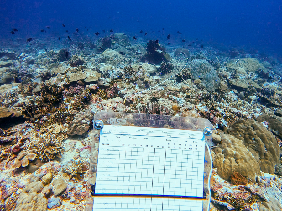
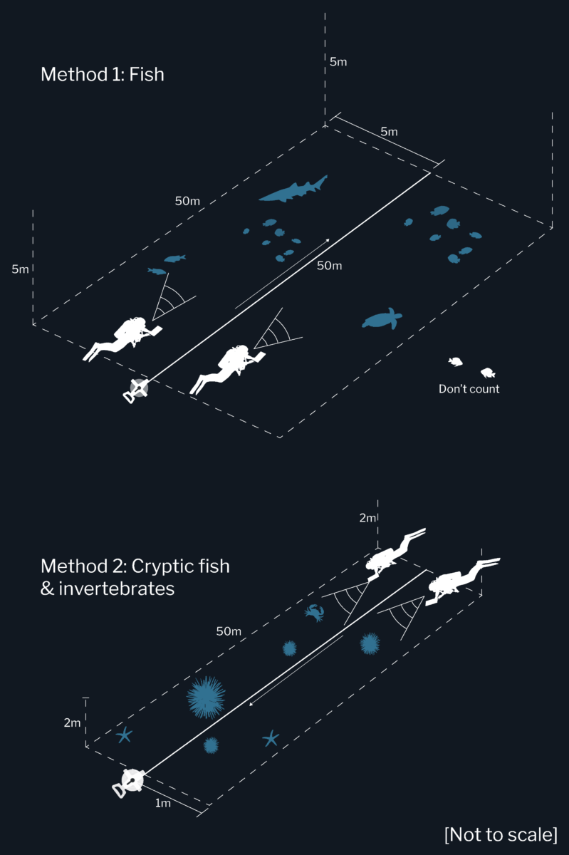
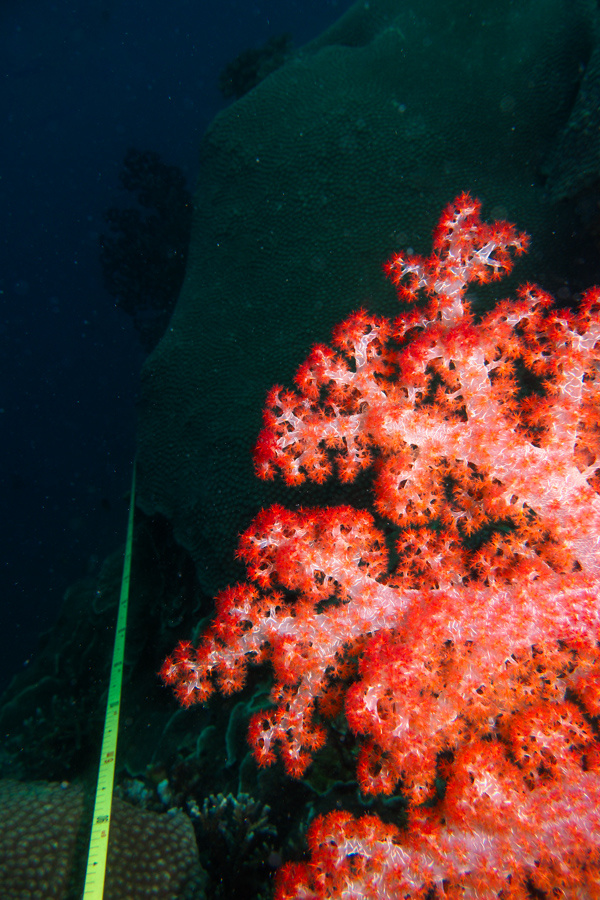
Survey involves rolling out two 50 m transect tapes per site, which can be completed by a buddy pair. There are 3 main parts to the methodology, Photo Quadrats, M1s, and M2s. Photo quadrats are straightforward, with a 30x30cm image taken of the seafloor every 2.5m along the tape.
M1 methods involve surveying almost all fish species within a 5m band to the side of the tape. M2 methods are for identifying invertebrates and cryptic fish. Divers swim back and forth along the tape, searching within 1 m either side of the transect line, surveying a total of 200m.
Expedition goals
The main goal of the trip was to resurvey sites from 3 years ago with the aim of continuing their current time series dataset. A secondary aim was to see if there were any cyclone impacts, and to do some exploratory dives to establish new sites on remote oceanic shoals. This data has led to the publication of multiple research papers, including a highly cited article in Nature.
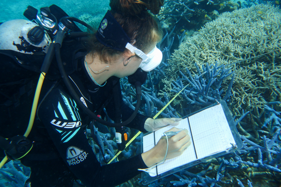
This is an important part of the method, where you photograph any species you’re unsure of and use the images for surface identification.
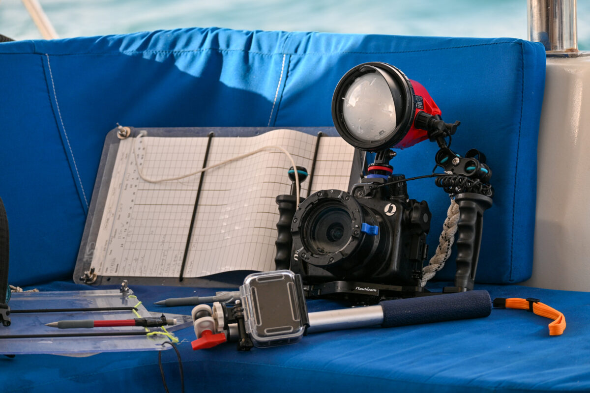
Carrying around my huge Reef Photo and Video camera setup with me on transect would have been impossible, so I constructed a smaller downsized version with just my Nauticam housing and one strobe that I could take on survey dives with me.
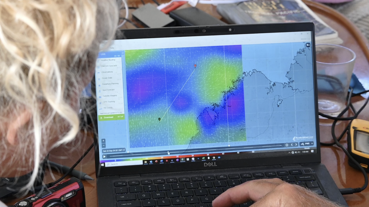
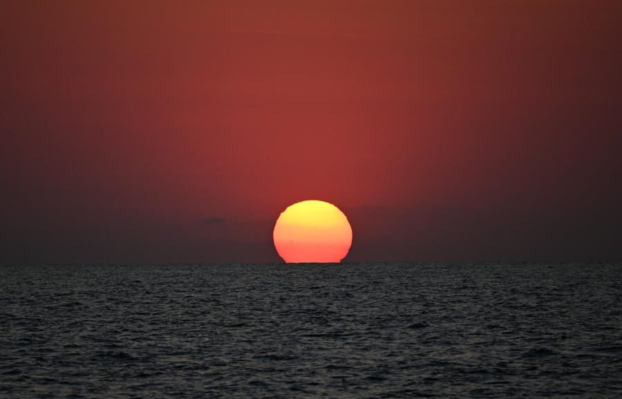
We were remarkably blessed with conditions while out on the water this trip. We’d be driving along in the tender, pinching ourselves, marvelling at the glass out day where the horizon and the ocean blended into one. The water was so still you could almost do a survey from the surface, watching the fish flit around on the reef below.
“You know the weather isn’t always like this, right?” skipper Gedgar kept reminding me with a laugh.
Prof. Edgars expertise in the marine environment became evident when it was time to sit down in the evenings and enter data from the day’s dives…
Whenever I couldn’t work out what a fish species was, I would show it to Graham and he would instantly know not only the fishes genus and species, but a plethora of information about where it was normally found, its life cycle, and even juvenile forms. It was surreal to be using reference books like Tropical Marine Life of Australia while chatting to the author of those books!
One of my favourite dives of the trip, a deep, spooky dive at the Cod Hole at Mermaid Reef. The deepest transect of our trip at 22m with lots of huge cod, and even dogtooth tuna cruising through in the background!
Overall we spent 3 ½ weeks under sail, visiting oceanic shoals in the Timor sea, Cartier Island, Ashmore Reef, Seringapatam Atoll, Scott Reef, and Mermaid, Clerke, and Imperieuse Reefs on the Rowley Shoals.
At Mermaid shoal we were astonished to find a group of 5 illegal fishing vessels, across the sea from Indonesia. Graham and I got the drones up, recorded this footage of their fishing techniques. After spotting the drones, they quickly removed themselves from the area. Luckily the WA Parks and Wildlife vessel was in the area and went to investigate, however, they have limited capacity to physically intervene.
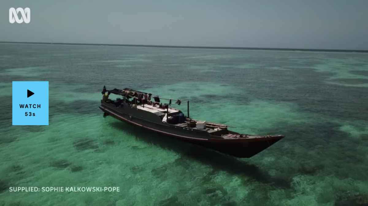
After the trip, both ABC and & News expressed interest in running a story with the drone media I had recorded. Subsequently I was interviewed two times and various articles on web, radio, and traditional TV news were created! The ABC news article got viewed over 150k times on Instagram; thus bringing exposure to the issue of illegal and unregulated fishing! A big thank you to Rosanne and Josh for your time and assistance.
Reflections…
I learnt so much on this expedition, from how to read the wind and tides, how to navigate, and sail, basic survey skills like how to set a good transect line, fish and invertebrate ID strategies, and even simple, practical tasks how to start a compressor and fill tanks!
This trip helped reinforce my love of sailing and ignite my passion for expedition science. I love everything about it – the routine, the sailing, the diving, the remoteness.
A sincere thank you to Graham for hosting me on Melita, and to himself and Kirsty for training me in the methodology. I treasured every minute on Melita.
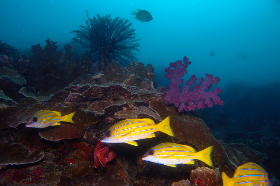
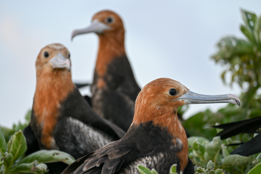
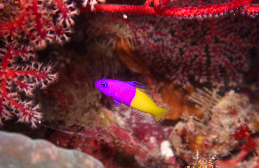
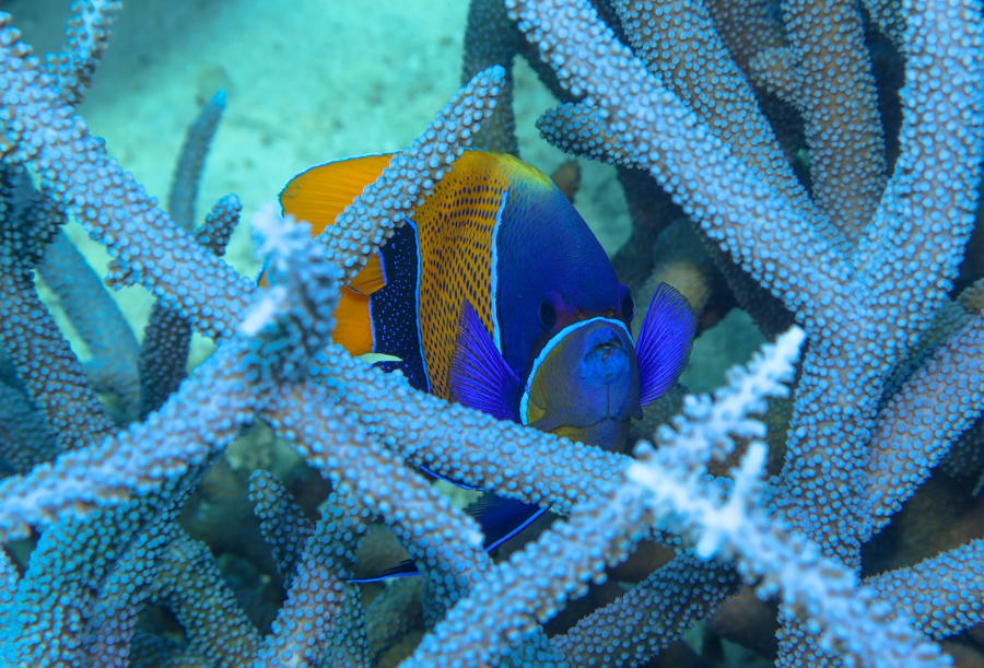
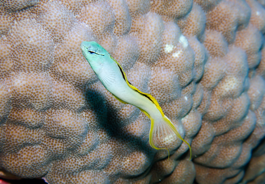
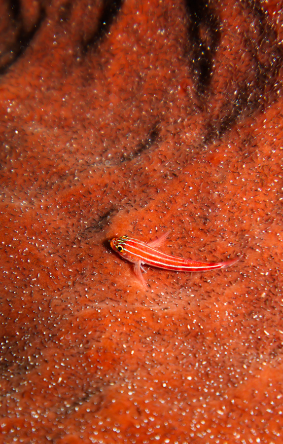
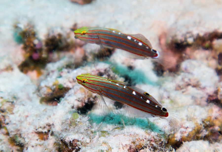
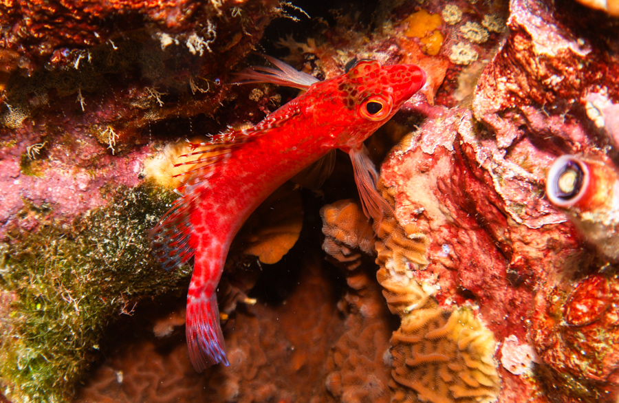
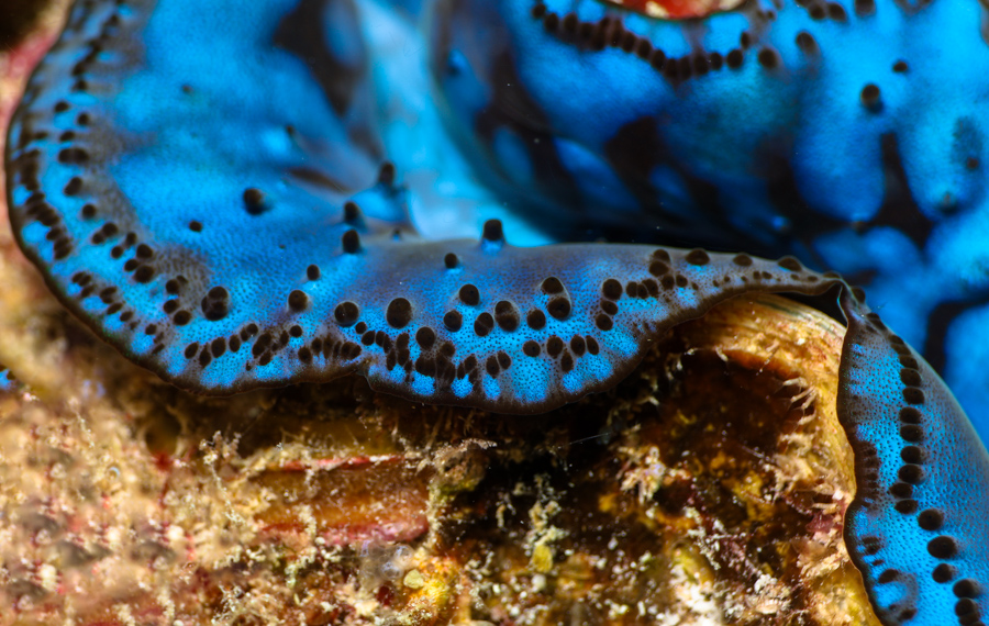
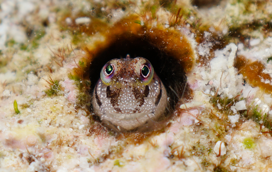
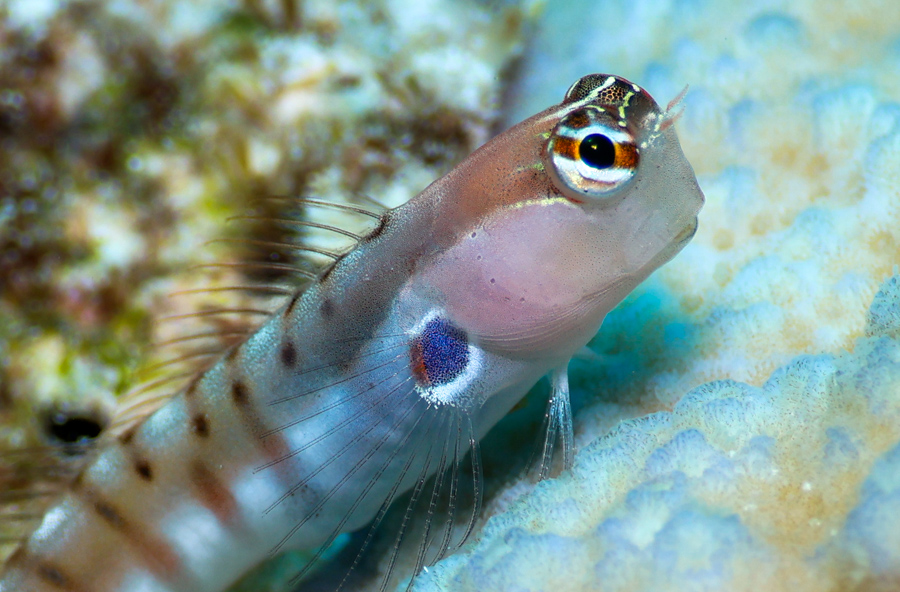
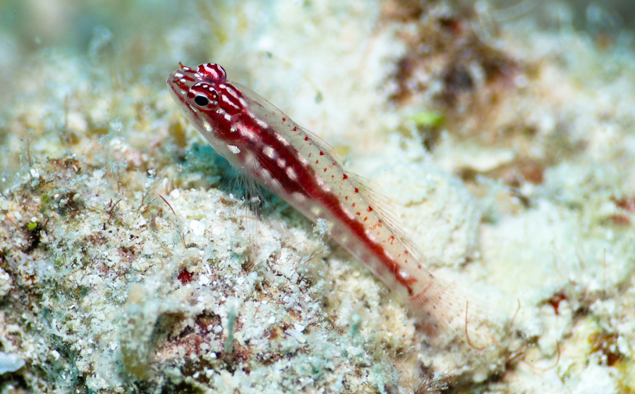
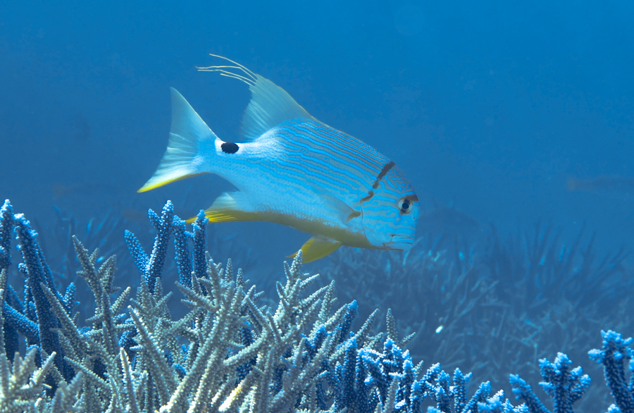
In the spirit of Reef Life Survey, here are some of my favourite fish ID shots from the trip.
“What is included here, is only a small fraction of what we have to lose.”
– Preface, Tropical Marine Life of Australia, Graham Edgar
I am so grateful to OWUSS for making opportunities I would not have dreamed of before and broadening my horizons to a global scale. A special thank you to the countless volunteers behind OWUSS, and the sponsors that make this scholarship possible at ROLEX. I would also like to thank my equipment sponsors at TUSA, Waterproof International, Reef Photo & Video, Mako Eyewear, my camera gear sponsors at Reef Photo & Video, Nauticam, and long time scholarship supporters DAN, and PADI.
To follow along on my adventures, I highly recommend you follow me on social media!
My Instagram @sophie_dives is where I post most regularly.
You can also contact me on LinkedIn, Twitter, Tiktok, and the Australasian Scholar Facebook Page.
You can also subscribe to this blog here!
